In 2026, nearly all homebuyers start their property search online, which means the quality of your listing visuals matters more than ever (National Association of Realtors, 2024). Real estate drone photography gives agents a way to show properties from a perspective that ground-level cameras simply cannot reach. Industry estimates suggest that listings with aerial photography sell faster than those without, though the exact figure varies by market and property type. If you have been curious about adding drone footage to your marketing but were not sure where to start, this guide covers what real estate drone photography is, how much it costs in 2026, what licensing you need, and how to get the most out of every shoot.
Find It Fast
Key takeaways
- Real estate drone photography uses unmanned aerial vehicles (UAVs) with high-resolution cameras to capture aerial images and video of properties.
- Listings with aerial photography tend to sell faster, and drone video drives higher engagement on social media than static images alone.
- As of 2026, the Federal Aviation Administration (FAA) requires a Part 107 Remote Pilot Certificate for anyone flying a drone commercially, including for real estate marketing.
- DIY drone options range from around $50 to $10,000 or more, depending on camera quality and flight capabilities. Professional drone photography packages typically start near $150 and can reach several thousand dollars for complex shoots.
- The best drone shots happen during golden hour (shortly after sunrise or before sunset) with a pre-planned shot list that includes wide, medium, and close-up angles.
- If you hire a professional, verify their Part 107 certification, insurance, and portfolio before booking.
What is real estate drone photography?
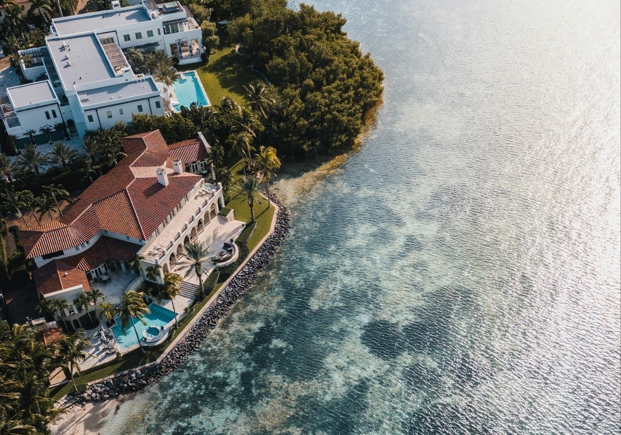
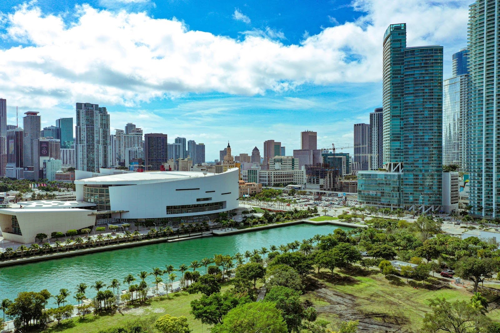
Real estate drone photography uses unmanned aerial vehicles equipped with high-resolution cameras to capture aerial images and video of properties. These drones fly at controlled altitudes above a home, lot, or neighborhood, recording footage that shows the full scope of a property and its surroundings. The result is a perspective that ground-based cameras cannot replicate, no matter how wide the lens.
For agents, this means you can show a buyer the relationship between a home and its lot lines, nearby parks, waterfront access, or mountain views in a single frame. That kind of context helps buyers understand not just the house, but the lifestyle that comes with it. It is especially useful for properties with large lots, waterfront locations, or proximity to desirable amenities that are hard to convey through interior photos alone.
Why use drone photography in 2026
As drone technology has become more accessible, the cost of adding aerial footage to your real estate photography has dropped significantly. Here are the main reasons to consider it for your next listing.
Better property visualization
Before a property hits the market, drones can inspect hard-to-reach areas like rooftops and wooded sections of large estates. This gives you detailed views that highlight maintenance needs or well-kept features. Once the home is ready for showings, aerial footage captures the full landscape, lot layout, and surrounding neighborhood in ways that ground-level shots miss.
Drones are especially good at highlighting features that photograph poorly from the ground. Think large backyards, swimming pools, scenic views, and proximity to parks or water. Combining aerial footage with ground-level shots gives buyers a complete picture of the property. That combination creates a narrative that resonates in a way static photos cannot.
A real edge in listing presentations
When you present drone footage during a listing appointment, you show sellers exactly how you plan to market their home. That transparency builds trust before a contract is signed. Sellers want to know their agent will go further than uploading a few smartphone photos to the MLS, and aerial imagery is one of the clearest ways to demonstrate that commitment.
In a market where many agents offer similar services, the quality of your visual marketing can be the deciding factor for a seller choosing between you and a competitor. Drone photography signals that you invest in your listings, and that investment often pays off in faster sales and stronger referrals.
Higher engagement on social media and listing platforms
Video content consistently outperforms static images on social media platforms. Drone footage, in particular, grabs attention because it offers a perspective most people never see in their daily lives. A 30-to-60-second aerial highlight reel posted to Instagram Reels or Facebook before a listing goes live on the MLS can generate buyer interest early. Some agents report receiving inquiries, and even offers, before the property appears on the MLS at all.
Drone videos are also more likely to be shared than standard listing photos. Each share extends the reach of your listing to new audiences without any additional cost. For agents building a social media marketing presence, aerial content is one of the strongest formats you can add to your rotation.
If you are already investing in real estate video marketing, drone footage is a natural next step that adds variety and visual impact to your content library.
Getting started with drone photography
Whether you want to fly a drone yourself or hire a professional, here is what you need to know before your first shoot.
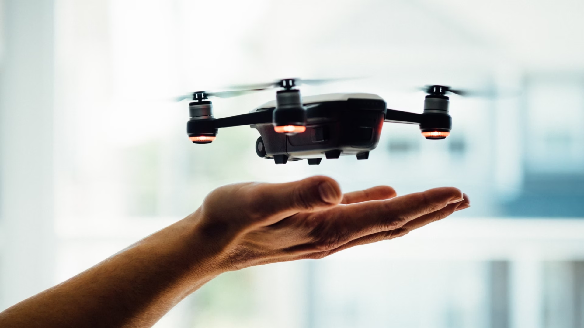
License requirements in 2026
As of 2026, the Federal Aviation Administration (FAA) requires anyone flying a drone for commercial purposes, including real estate photography, to hold a Remote Pilot Certificate under Part 107. To earn this certificate, you must pass the FAA’s Aeronautical Knowledge Test, which covers airspace regulations, weather effects, drone operations, and emergency procedures. You will also need to pass a TSA background check.
The test is not as intimidating as it sounds. Many agents study for two to four weeks using online prep courses and pass on the first attempt. Once certified, your Remote Pilot Certificate is valid for 24 months before you need to take a recurrent knowledge test. If you plan to fly regularly, the time investment is well worth it. If not, hiring a licensed operator (covered below) is the simpler path.
Drone costs and options in 2026
As of 2026, drone prices generally fall into four tiers based on camera quality, flight time, and feature set. The table below breaks down what to expect at each level.
| Tier | Price range | Camera quality | Flight time | Best for |
| Entry-level | $50 to $200 | Basic camera, limited resolution | 5 to 15 minutes | Beginners learning to fly before investing in better equipment |
| Mid-range | $200 to $1,000 | 1080p or 4K video | 15 to 30 minutes | Agents testing drone photography on a few listings |
| High-end consumer | $1,000 to $2,500 | 4K or 6K video, higher megapixel photos | 30+ minutes | Agents who shoot regularly and want strong image quality |
| Professional | $2,500 to $10,000+ | 4K to 8K video, interchangeable lenses | 30+ minutes with extended batteries | Full-time real estate photographers and videographers |
Prices verified: 2026. Verify current pricing at DJI.com or a comparable retailer before purchasing.
Mid-range and high-end consumer drones often include features like Global Positioning System (GPS) tracking, obstacle avoidance, and automated flight modes that make them easier to operate. For most agents who plan to fly their own drone, the $1,000 to $2,500 range offers the best balance of image quality and ease of use.
Hiring a professional drone operator
If you do not have the time or interest in getting licensed, hiring a professional is the faster route. Before you book anyone, ask these three questions:
- Are they licensed under Part 107 and insured for commercial drone operations?
- What camera and drone equipment do they use?
- Does their portfolio match the style and quality you want for your brand?
What professional real estate drone photography costs
As of 2026, professional drone photography packages for real estate typically fall into these ranges:
- Basic packages ($150 to $300): A set number of aerial photos, minimal editing, and quick turnaround. Good for standard residential listings.
- Mid-tier packages ($300 to $800): Aerial photos plus a short edited video, color correction, and sometimes a neighborhood flyover. A strong fit for most listings.
- Full packages ($800 to $3,000+): Aerial photos, longer edited video, virtual tour integration, music, voiceover, and advanced post-production. Best for high-value properties or agents who want a full marketing asset.
Several factors affect pricing. Location matters: operators in high-demand urban markets often charge more than those in rural areas. The size and complexity of the property also play a role, since larger estates require more flight time and more editing. An operator’s experience and reputation will influence their rates as well.
Getting the most value from your hire
- Compare quotes: Get quotes from at least three providers so you can compare services and pricing side by side.
- Check portfolios: Review past work to make sure the operator’s style and quality match your expectations.
- Clarify deliverables: Confirm the number of photos, length of video, and level of post-production work included in the package.
- Ask about revisions: Find out whether the price includes revisions or additional edits to photos and videos.
Top tips for real estate drone photography in 2026
Whether you are shooting footage yourself or working with a professional operator, follow these six steps to capture high-quality aerial images and video of real estate properties.
- Plan your shots
- Visit the property in advance and identify the features you want to highlight: the house, yard, pool, garden, and surrounding neighborhood.
- Create a shot list that includes wide shots, medium shots, and close-ups. Share this list with your drone operator if you are not flying yourself.
- Consider timing
- Shoot during golden hour, shortly after sunrise or before sunset. This window provides soft, warm light that makes properties look their best.
- Avoid overcast or rainy days. Clear skies with minimal wind give you the best conditions for stable, sharp footage.
- Establish your flight path
- Plan your route to capture smooth, steady footage. Practice gradual movements and avoid jerky direction changes.
- Vary your altitude to get a mix of perspectives, but do not fly so high that property details become hard to see.
- Confirm you have permission to fly in the area. This may include consent from property owners and neighbors, plus compliance with local altitude limits, no-fly zones, and privacy rules.
- Use the right camera settings
- Set your camera to the highest resolution available for sharp, detailed images.
- Use manual settings when possible to control exposure, ISO (the camera’s light sensitivity setting), and shutter speed based on lighting conditions.
- Turn on high dynamic range (HDR) to capture more detail in both shadows and highlights.
- Apply composition principles
- Follow the rule of thirds. Place the property along the grid lines or at their intersections for a balanced frame.
- Use natural lines like driveways, pathways, or fences to lead the viewer’s eye toward the home.
- Include foreground elements that add depth and context to the image.
- Edit your footage
- Use photo and video editing software to adjust brightness, contrast, saturation, and sharpness.
- Stabilize video clips to remove shakes or jitters.
- Apply color correction so hues look consistent and natural across all images and videos.
Drone photography in action
Drone footage becomes most powerful when it is built into a website designed to showcase it. Here are three examples of how Luxury Presence agents use aerial imagery to set the tone for their brand from the first frame.
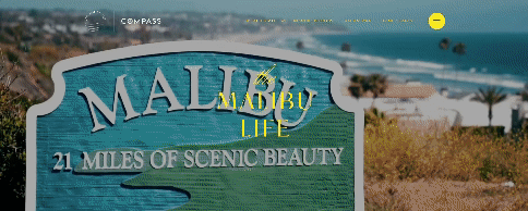
Madison Hildebrand’s The Malibu Life
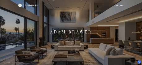
Adam Brawer
Bernadette Meyer
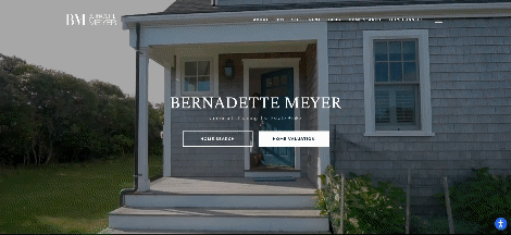
Each of these sites uses aerial video as the hero element on the homepage, creating an immediate sense of place that static photos cannot match. If you are building or refreshing your real estate website, consider how drone footage could anchor your visual brand.
Putting drone photography to work in real estate
Real estate drone photography can give your listings stronger visual context, better engagement, and a more polished presentation when it is planned well and executed within the right licensing rules. Whether you choose to fly yourself or hire a professional, focusing on timing, composition, and clear deliverables will help you get the most value from every shoot. With the right approach, aerial imagery can become one of the most effective tools in your marketing toolkit.
FAQs
Run your social strategy by our experts
From developing a calendar to posting content, our team can grow your following, increase engagement, and establish you as a market and lifestyle expert.
About the author
Kate Evans is a content marketing strategist at Luxury Presence, the leading growth platform for high-performing real estate professionals. She develops data-driven editorial content and supports SEO strategy and brand voice frameworks that help agents attract qualified leads and establish market authority. Her published work covers topics including CRM strategy, social media marketing, and digital growth, supporting thousands of agents in scaling their businesses through modern marketing.